Infrastructure Inspection
In today's rapidly evolving technological landscape, the use of drones has revolutionized the way infrastructure inspections are conducted. With our ability to capture high-resolution imagery, collect data from hard-to-reach locations, and employ advanced sensors such as thermal imaging, drones have become indispensable tools for assessing the condition, safety, and integrity of various infrastructure assets, including roads, railways, bridges, public utility district (PUD) assets, and more. Below are a few ways in which drone data is transforming infrastructure inspections and how thermal imaging technology is revolutionizing the detection of critical issues.

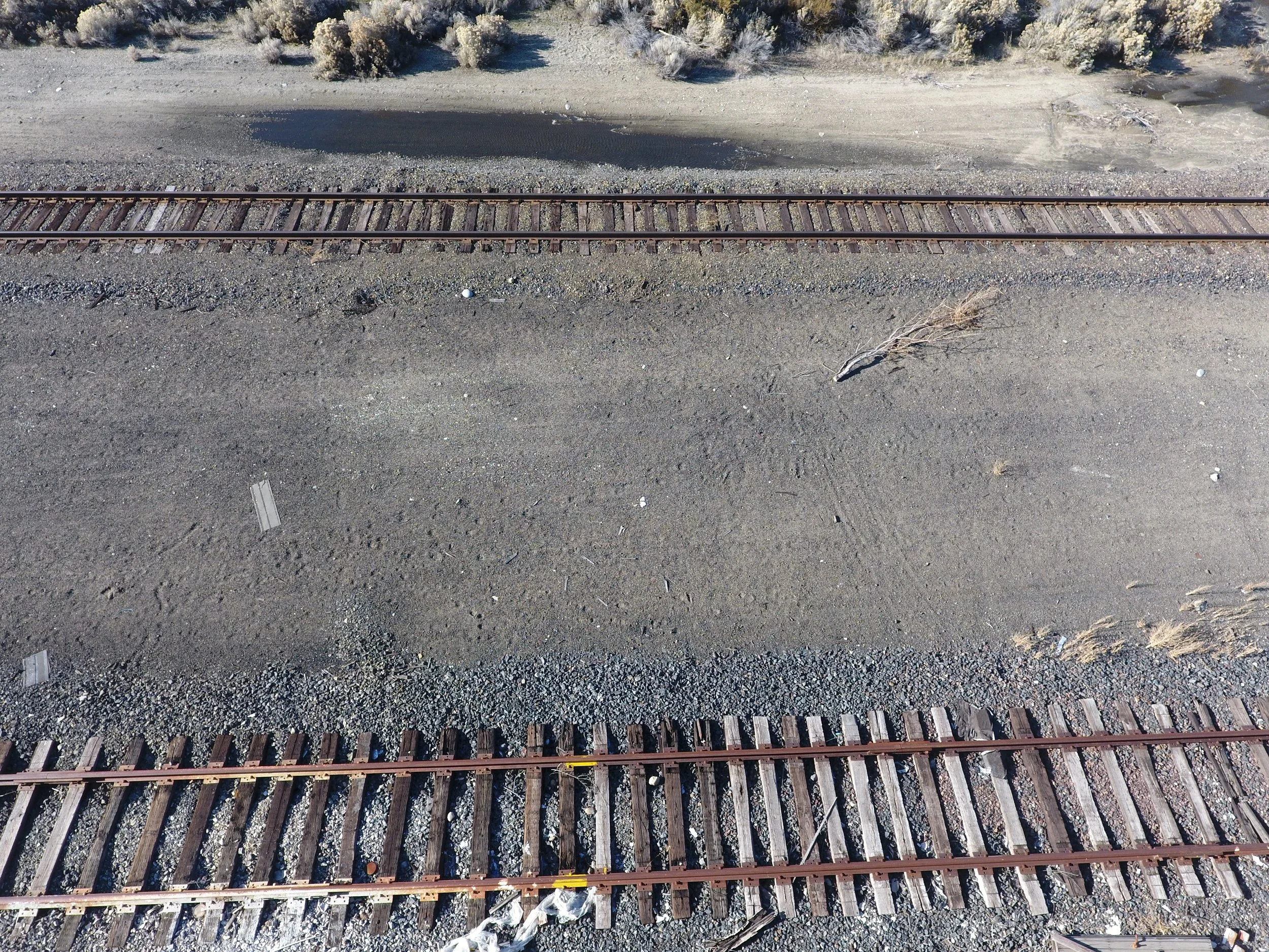
Road and Railway Inspections
Drones are playing a vital role in road and railway inspections by providing comprehensive aerial data of transportation networks. Equipped with high-resolution cameras, drones can capture detailed imagery of roads, railways, and associated infrastructure, enabling inspectors to identify signs of wear and tear, pavement distress, drainage issues, and encroachments. Additionally, drones equipped with thermal imaging sensors can detect temperature variations on road surfaces, identifying areas of potential concern such as overheating or delamination, which may indicate underlying structural issues or pavement failures. In addition to identifying problems, this data helps in updating maintenance schedules and allocating resources effectively.
Bridge Inspections
Bridge inspections are another area where drones are making a significant impact. Drones equipped with high-resolution cameras can conduct detailed visual inspections of bridge structures, including decks, piers, abutments, and support systems. Thermal imaging sensors mounted on drones can detect anomalies such as cracks, delamination, or corrosion in bridge components, which may not be visible to the naked eye. By capturing thermal data, inspectors can pinpoint areas of concern and prioritize maintenance or repair efforts to ensure the structural integrity and safety of bridges.

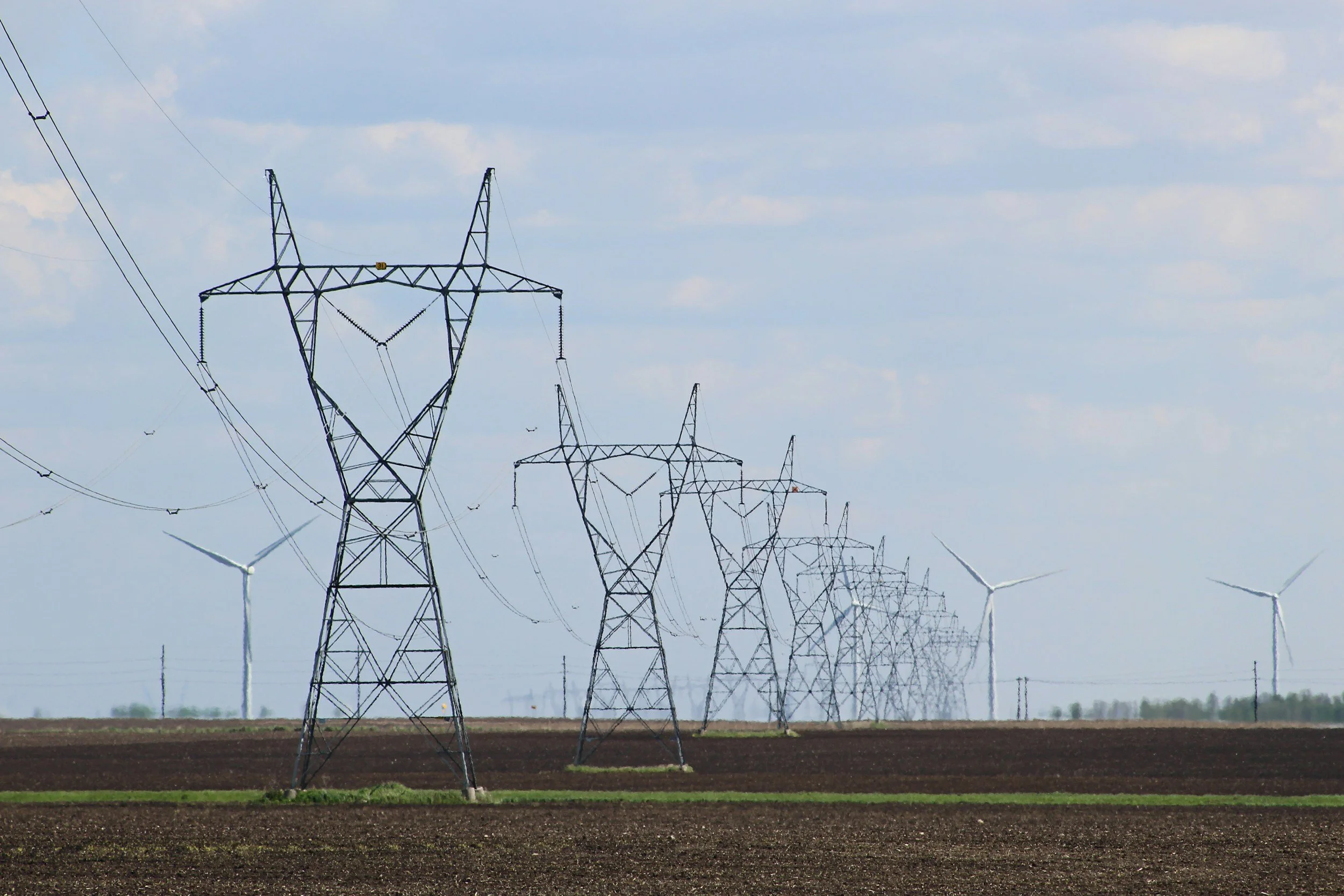
Public Utility District (PUD) Asset Inspections
Drones are increasingly used for inspecting public utility district (PUD) assets such as power lines, substations, and utility poles. By conducting aerial surveys of utility networks, drones can identify vegetation encroachments, equipment failures, and potential safety hazards, helping utility companies ensure reliable service delivery and prevent outages. Thermal imaging sensors mounted on drones are particularly effective for detecting hot spots or anomalies in electrical components, such as malfunctioning transformers or faulty connections, which may indicate imminent failures or fire risks.
Other Infrastructure Items
In addition to roads, railways, bridges, and PUD assets, drones are used to inspect a wide range of other infrastructure items, including pipelines, dams, levees, buildings, and industrial facilities. Drones equipped with specialized sensors and imaging technology can capture detailed data of these assets, enabling inspectors to assess their condition, detect defects, and identify potential safety hazards. Thermal imaging technology, in particular, is invaluable for identifying hot spots, leaks, or abnormalities in infrastructure components, allowing inspectors to take proactive measures to mitigate risks and ensure the reliability and safety of critical infrastructure.